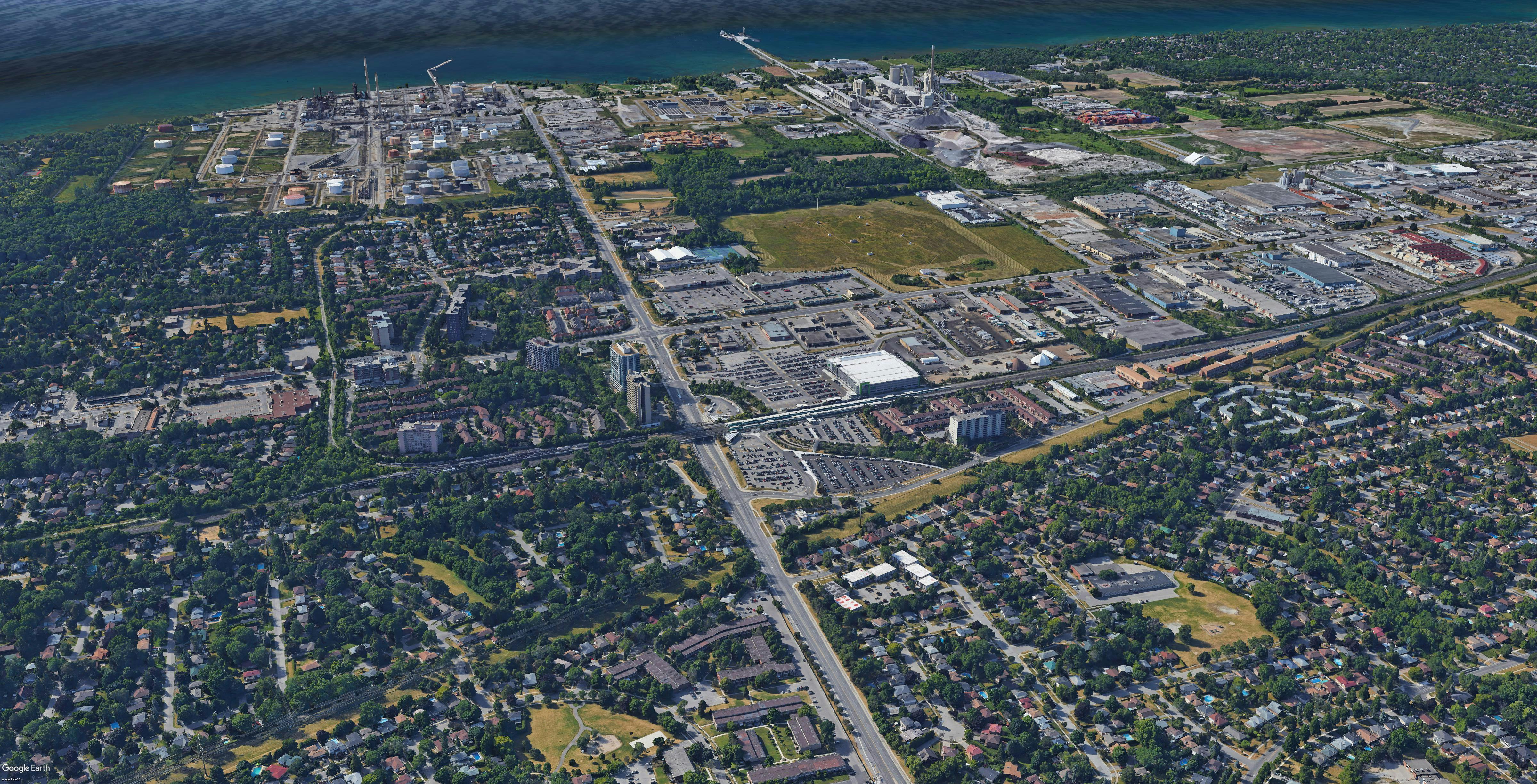
Clarkson GO Major Transit Station Area Study
The Government of Ontario and its partners at Metrolinx are investing in convenient, integrated transit across the province. This includes electrification of our GO train lines. In Mississauga, the Lakeshore West GO line will undergo changes to allow for electrification and 15 minutes, all day two-way service. In 2018, the City of Mississauga (City) initiated the Clarkson GO Major Transit Station Area (MTSA) Study, in partnership with the Region of Peel, to plan for new residential uses in the area.
The City retained a consultant team led by The Planning Partnership to develop a master plan for the area surrounding the Clarkson GO Station. On May 14, 2025, City Council endorsed a new master plan to shape growth and development for the area.
It identifies:
- Ways to create a complete community with residential and employment uses, a main street, parks and public spaces
- Locations for new homes and appropriate buildings, heights and density around transit
- Enhancements for pedestrian, cycling, road and transit connections
City planning staff have prepared official plan policies for the area surrounding the Clarkson GO station that implements key directions from the master plan. The proposed policies plan for a walkable, transit-supportive community, complete with a mix of uses.
Key policy changes include:
- A vision and guiding principles
- Identifying a portion of the Clarkson GO MTSA as a Growth Node for taller buildings
- Planning for future roads and pedestrian connections
- Providing for a mix of uses with access to a walkable main street, parks, homes, jobs and shops
Review the proposed policies for the Clarkson GO MTSA:
Mississauga Official Plan 2051 Policy Modification
Mississauga Official Plan 2051 Schedule Modifications
Stay involved
Subscribe to receive news alerts about future engagements at the top of the page.
If you wish to mail your comments, please send them to: Christian Binette, City Planning Strategies, 7th Floor - Planning and Building, City of Mississauga, 300 City Centre Dr, Mississauga, ON L5B 3C1.
Who is Listening
-

Phone 905-615-3200 X5753 Email christian.binette@mississauga.ca
Document Library
-
 Clarkson GO MTSA Draft Official Plan Policies (September 2025)
-
Public Meeting (September 22, 2025) Recommendation Report
-
 Clarkson GO MTSA – Policy Modifications to Mississauga Official Plan 2051 Recommendation Report (411 KB) (pdf)
-
Staff Presentation - Clarkson GO MTSA Policy Modifications (2.32 MB) (pdf)
-
Appendix 1 - Key Project Milestones (651 KB) (pdf)
-
Appendix 2 - Corporate Report titled Clarkson GO Major Transit Station Area – Update and Next Steps (46 MB) (pdf)
-
Appendix 3 - List of Corporate Reports (650 KB) (pdf)
-
Appendix 4 - MOP 2051 Schedule Modifications (6.46 MB) (pdf)
-
Appendix 5 - Red-line Policy Modifications (4.53 MB) (pdf)
-
Appendix 6 - Response to Comments (743 KB) (pdf)
-
Appendix 7 - Applicable Policy Analysis (856 KB) (pdf)
-
-
Clarkson GO MTSA Draft Official Plan Policies (June 18, 2025)
-
Public Meeting (April 28, 2025) Recommendation Report
-
PDC Report- Dec 9 2024 Recommendation Report
-
Public Meeting (December 7, 2020) Recommendation Report
-
Public Meeting (October 19, 2020)
-
Status Update to Council (June 17, 2020)
-
Air Quality Study
-
Clarkson Air Quality Study Summary | March, 2023 (979 KB) (pdf)
-
Peer Review Executive Summary | Clarkson Air Quality and Human Health Assessment, March 2023 (791 KB) (pdf)
-
Air Quality Study Monitoring and Dispersion Modelling Report | February 16, 2023 (2.98 MB) (pdf)
-
Human Health Assessment | December 09, 2022 (1.37 MB) (pdf)
-
Appendix | Mitigation Options (810 KB) (pdf)
-
-
 Background Report (95.1 MB) (pdf)
-
Engagement Materials
-
Video- Clarkson GO Major Transit Station Area Study - Community Meeting 5 - June 18 2025
-
Community Meeting 5 - Presentation (4.25 MB) (pdf)
-
Community Meeting #4 - Presentation (6.43 MB) (pdf)
-
Video _ Clarkson GO Major Transit Station Area Study - Community Meeting _4_ November 22_ 2023
-
Video | Clarkson GO Major Transit Station Area Study - Community Meeting #3, March 23, 2023
-
Community Meeting # 3 - Presentation (1.52 MB) (pdf)
-
Community Meeting #2 - Presentation (13.2 MB) (pdf)
-
Community Meeting #1 - Presentation (17.2 MB) (pdf)
-
-
What We Heard
-
Clarkson Area Master Plan (145 MB) (pdf)